In October of 2016 I was living in Denver on Inca Street off of West 8th Ave when my home became infested with junkies. Naturally, it was time for me to find a new place so that the junkies could destroy the house in peace without me being there. But before I got on Craigslist, I applied my super secret method of checking the map, looking at the patterns, and identifying the neighborhood I was destined to live in next. Upon searching the listings, I found a nice ad, but it didn’t provide an address for obvious security reasons yet my instinct was telling me this is it, and so I found myself at a Taco Bell being interviewed and submitting my information for a background check. When I saw that the interview was going well, that’s when I suddenly pulled out the stops.
“You don’t need to tell me where the house is. I already know. You see, there is this pattern on the map that shows me where the next place of significance in my life will be, which is usually a workplace or residence. This time the x marks the spot at the intersection of West Ohio Avenue and South Newton Street, at the corner of an elementary school.”
Her face went white and she abruptly got up and left the scene without a word, presumably to run home to tell her husband, Tom, to beef up the home security because a lurker was stalking them who knew where they lived.
Okay, so that part about me “checking the map” and telling her about my foreknowledge of the location of the house I made up just now for the purpose of providing an opening anecdote portion for this post, but I could have freaked her out with my knowledge of where their house is, you see. If only I had, prior to the meeting, noticed these aforementioned patterns that would tell of my moving there, what a reaction I’d receive, right?!
This method I have named cartograstrology, and I even made a video about it a few years back on YouTube. There is a potential practical usefulness like what I described in the above anecdote that may go well beyond amusement at others’ astonishment. Perhaps this could be a scientific window into how consciousness works or even a proof for the existence of God. Who knows? What I do know is that I’ve created this blog post for my own wonderful lurkers. You can follow along, too, if you wish. All are welcome to learn how to “check the map” with me!
How to make a cartograstrological chart
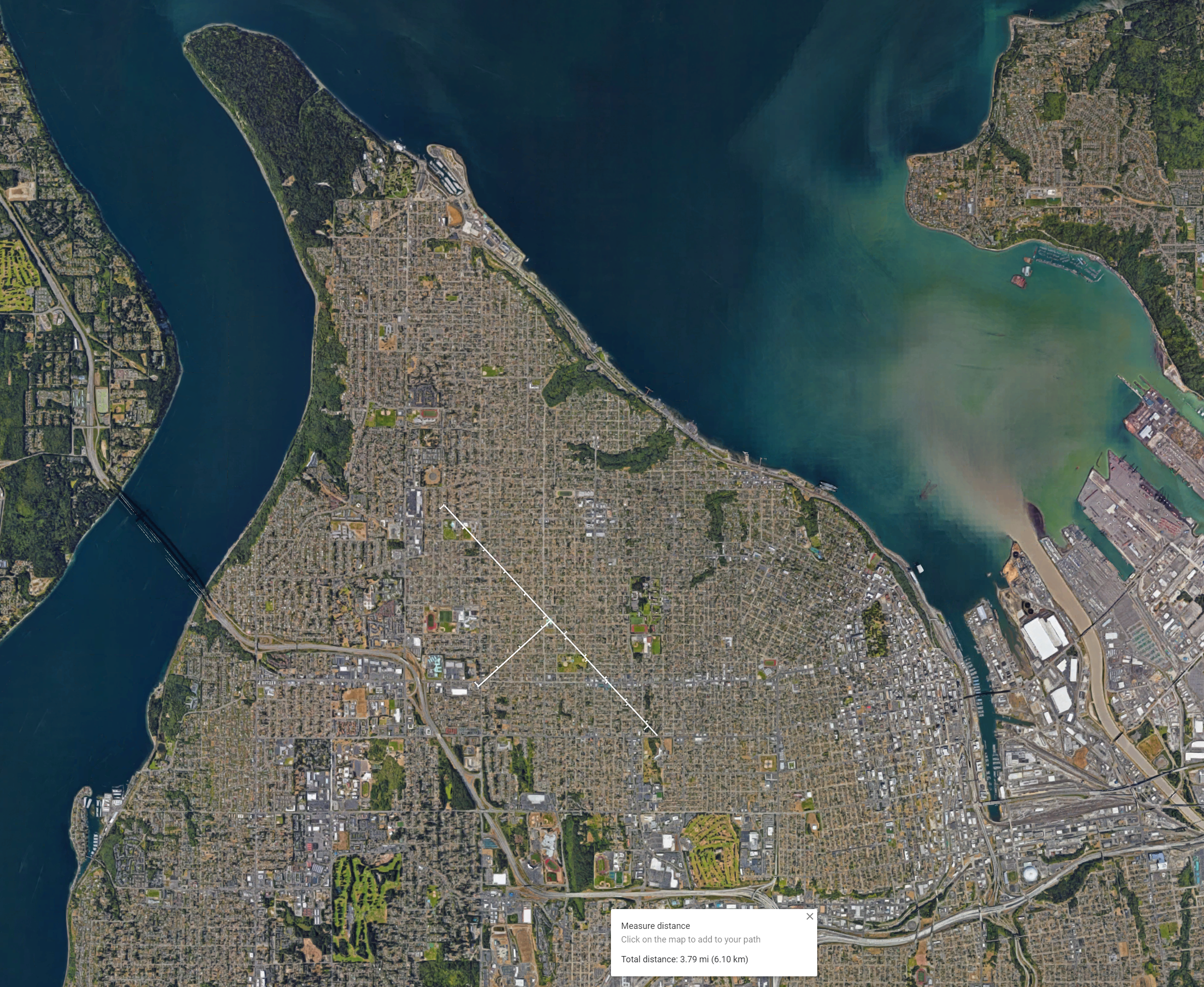
First, we need to set up the map with its base framework components. Let’s do it together! Open up Google Maps and place down some points: mark my childhood home, and then my residence in 2007 where I discovered cartograstrology. At the midpoint of this line segment, place a perpendicular line. That line passes right through my workplace at the time in 2007. So far so good, right?
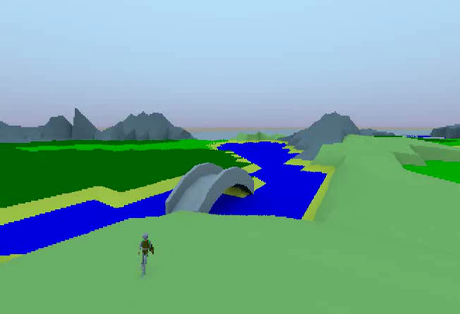
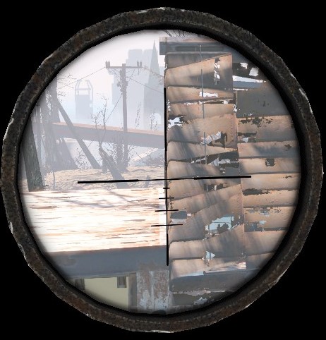
Now, in 2015 while I was living in the Inca house and while it was still occupied with wholesome people, I awaited the release of my favorite game: Fallout 4.
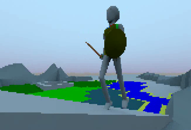
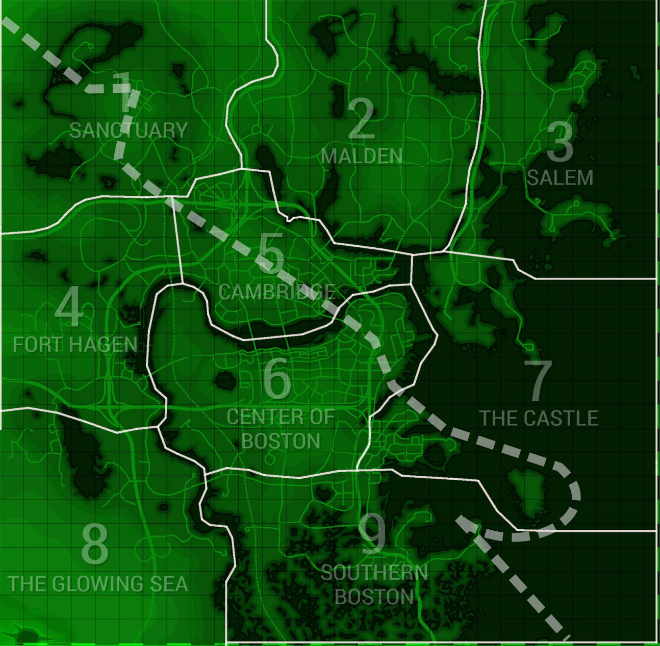
In the game, if you stand just above the front door of the Sole Survivor’s Sanctuary Hills home, you can use your scope to get a visual of the places of significance along a straight line that your character will visit as you progress through the main story, should you take the path of the Minutemen:
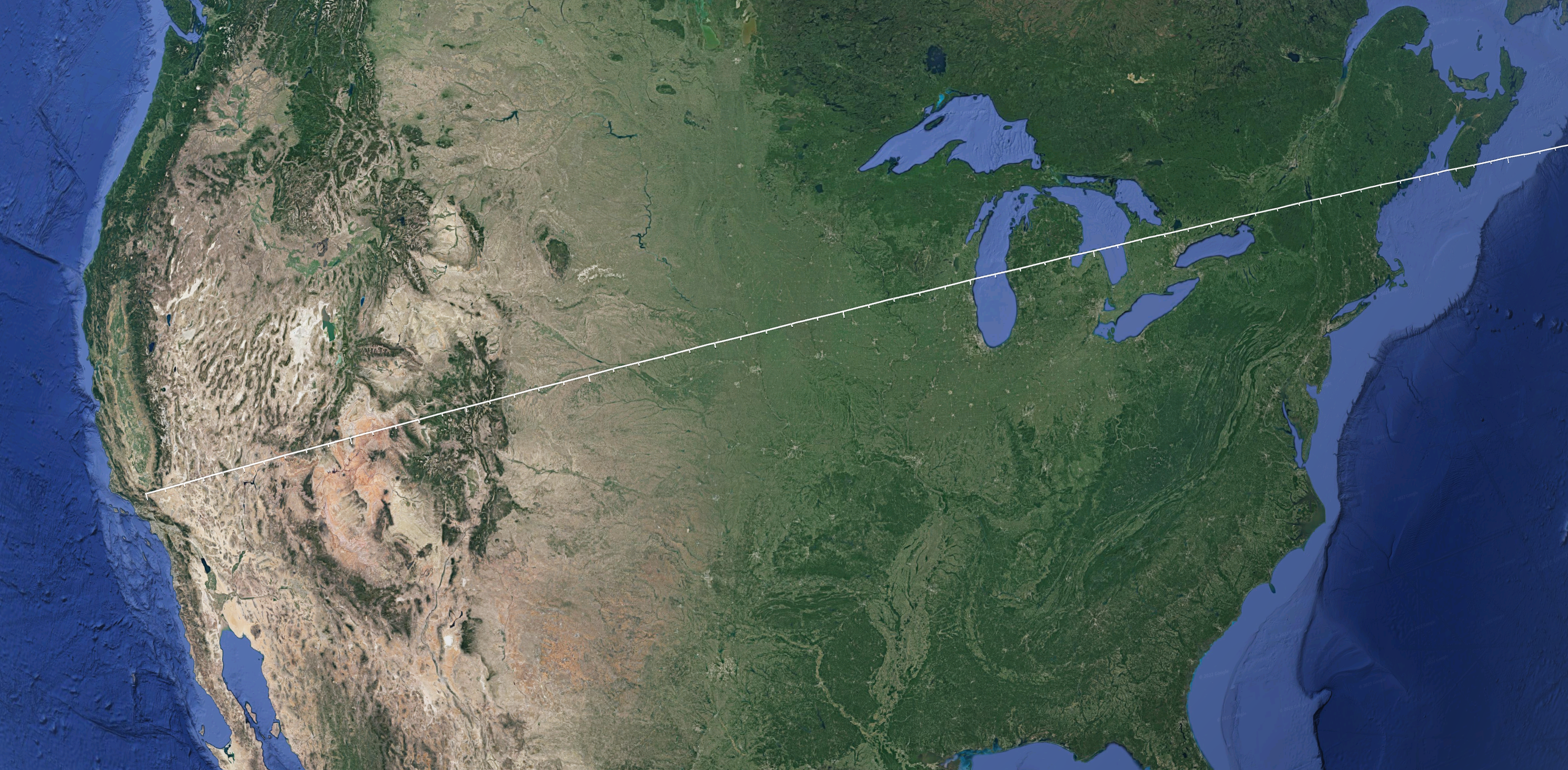
Next, get on Google Maps and trace that line we just found in the game, and take it all the way as far as it goes in both directions.
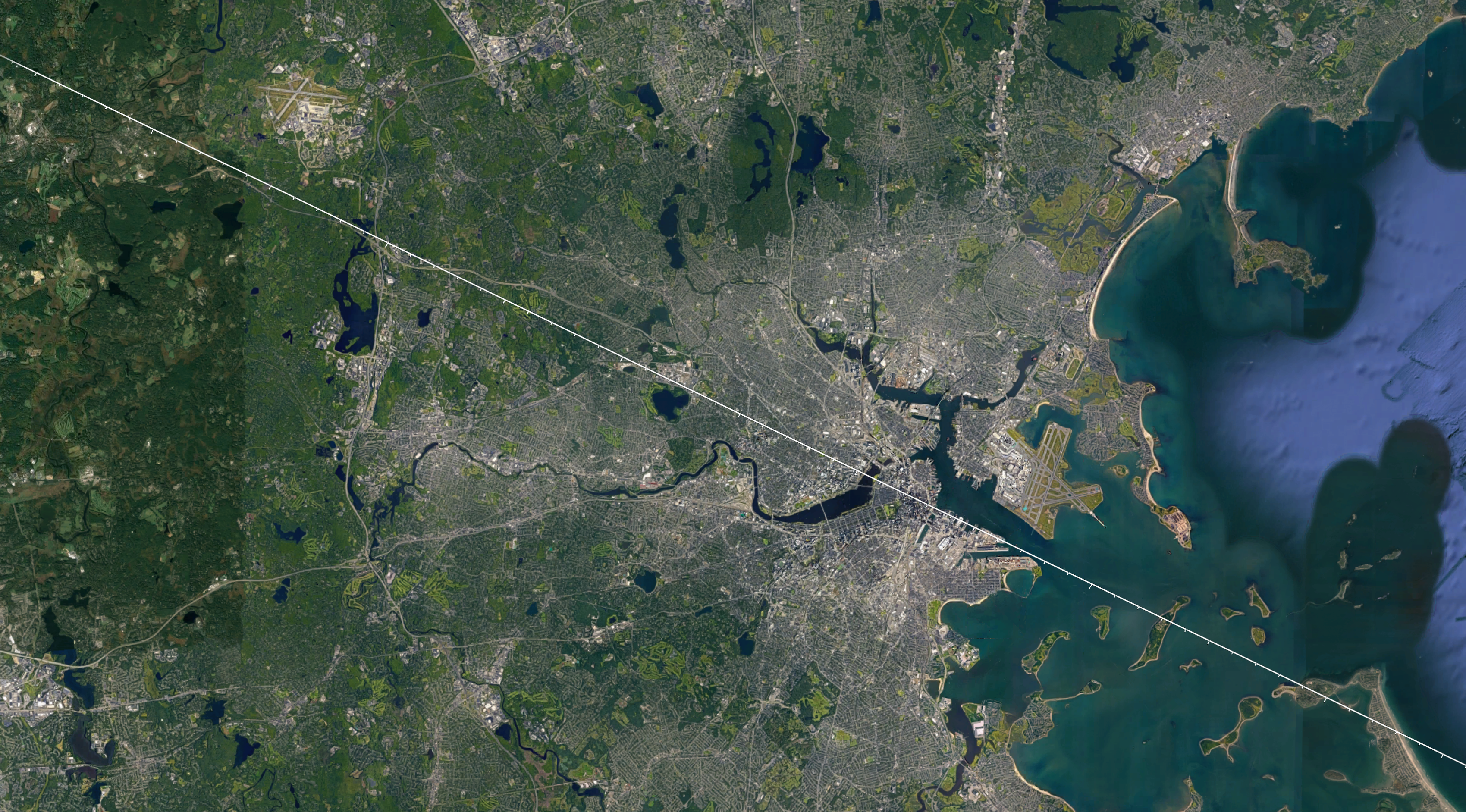
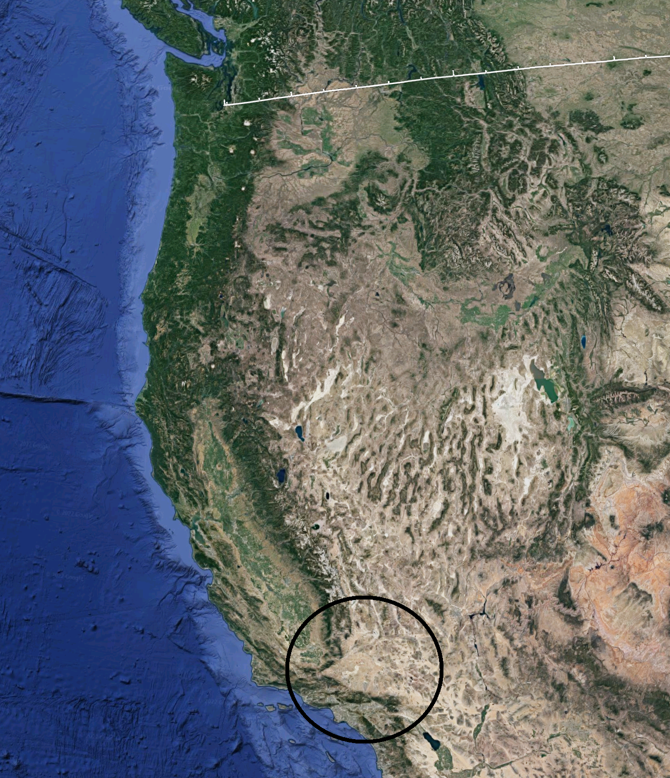
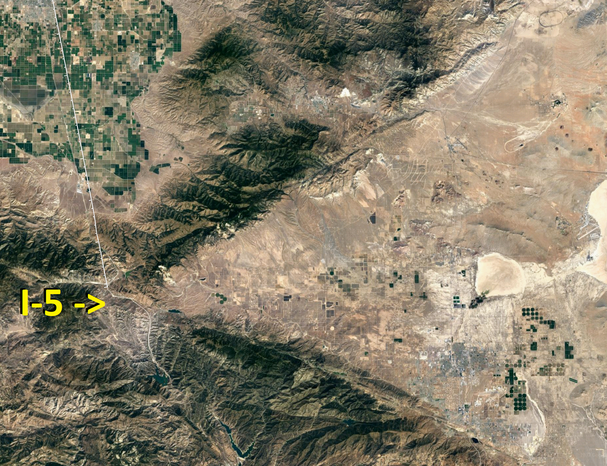
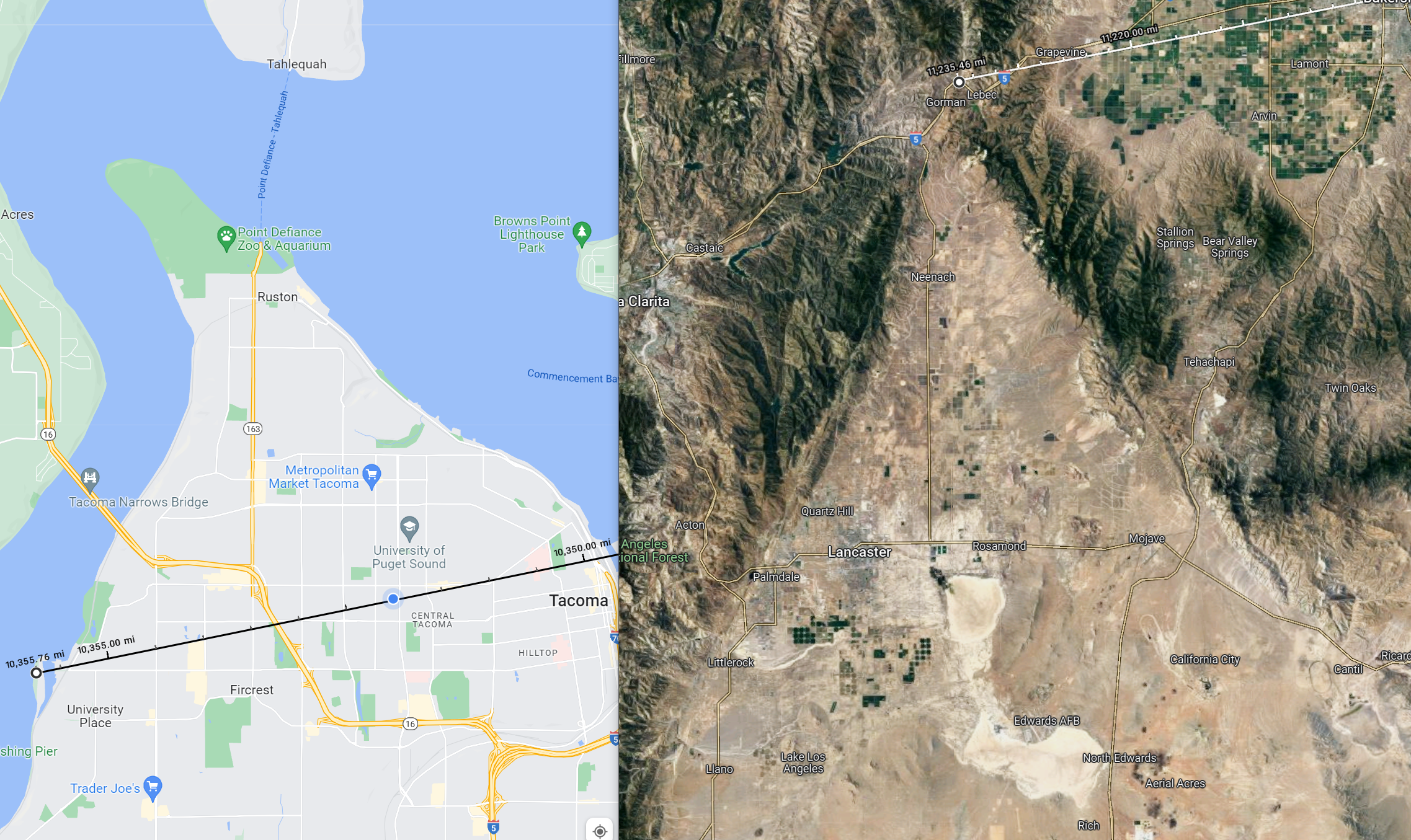
See? The line takes you as far as Infanta on the southern shore of Africa, which comes from the word infant (as in Shawn who was taken by the Institute as an infant) and Days Island in Tacoma, which gives you a total distance of 16,666 kilometers. From Days Island, draw a line south until you find a topographical feature in Los Angeles county that resembles Tacoma, and place your point on the western tip of that triangle along I-5, which is the road system that also runs through Tacoma.
Rotate your map clockwise by 90 degrees and now let’s stop and compare. Looks like we are on to something!
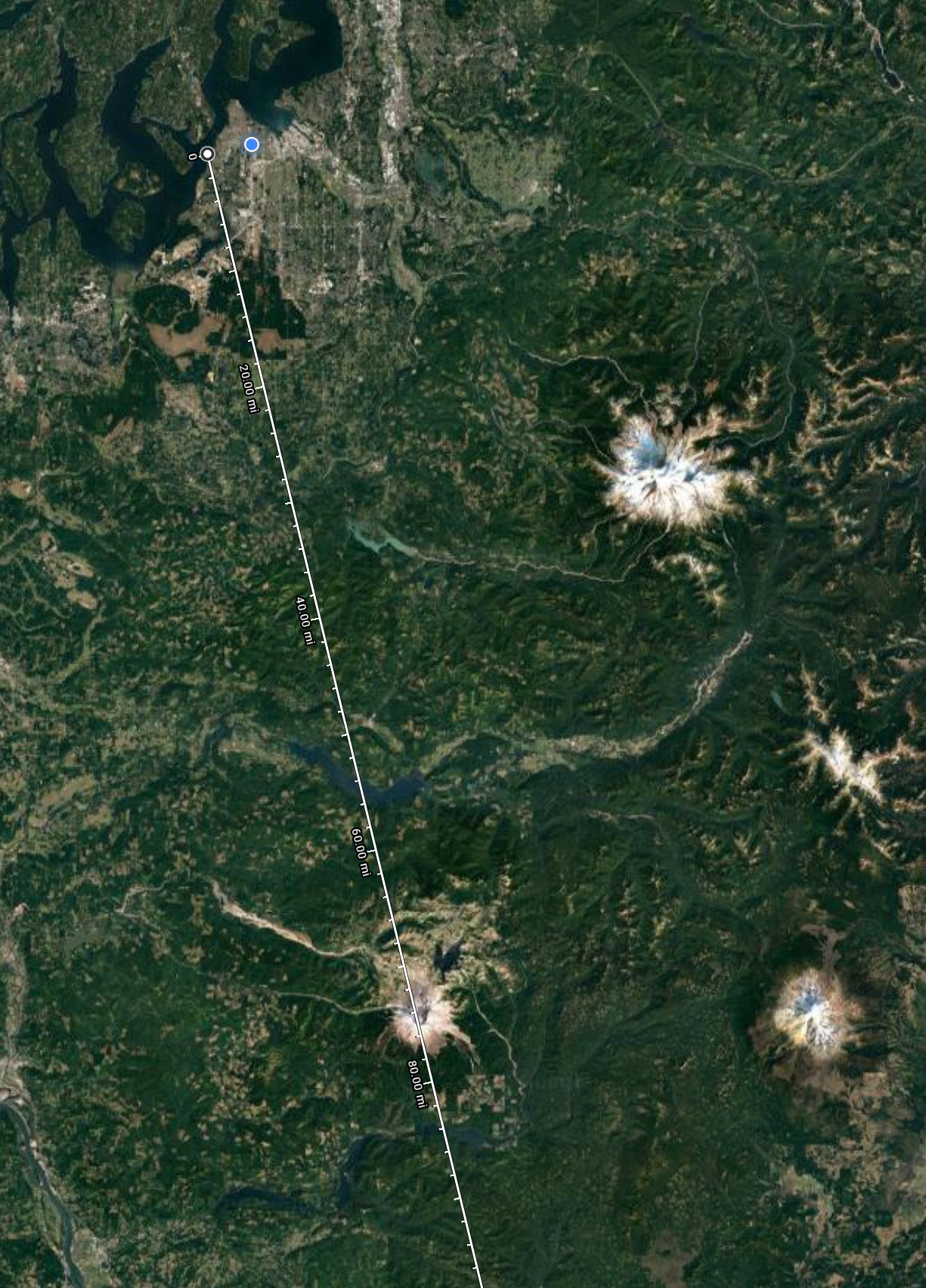
Note how the direction of the shore in Ruston in Tacoma points to Mount Rainier, which creates a line nearly parallel to the one we drew using my workplace and residences in Tacoma. Pay attention to the mountain – this will come in handy later.
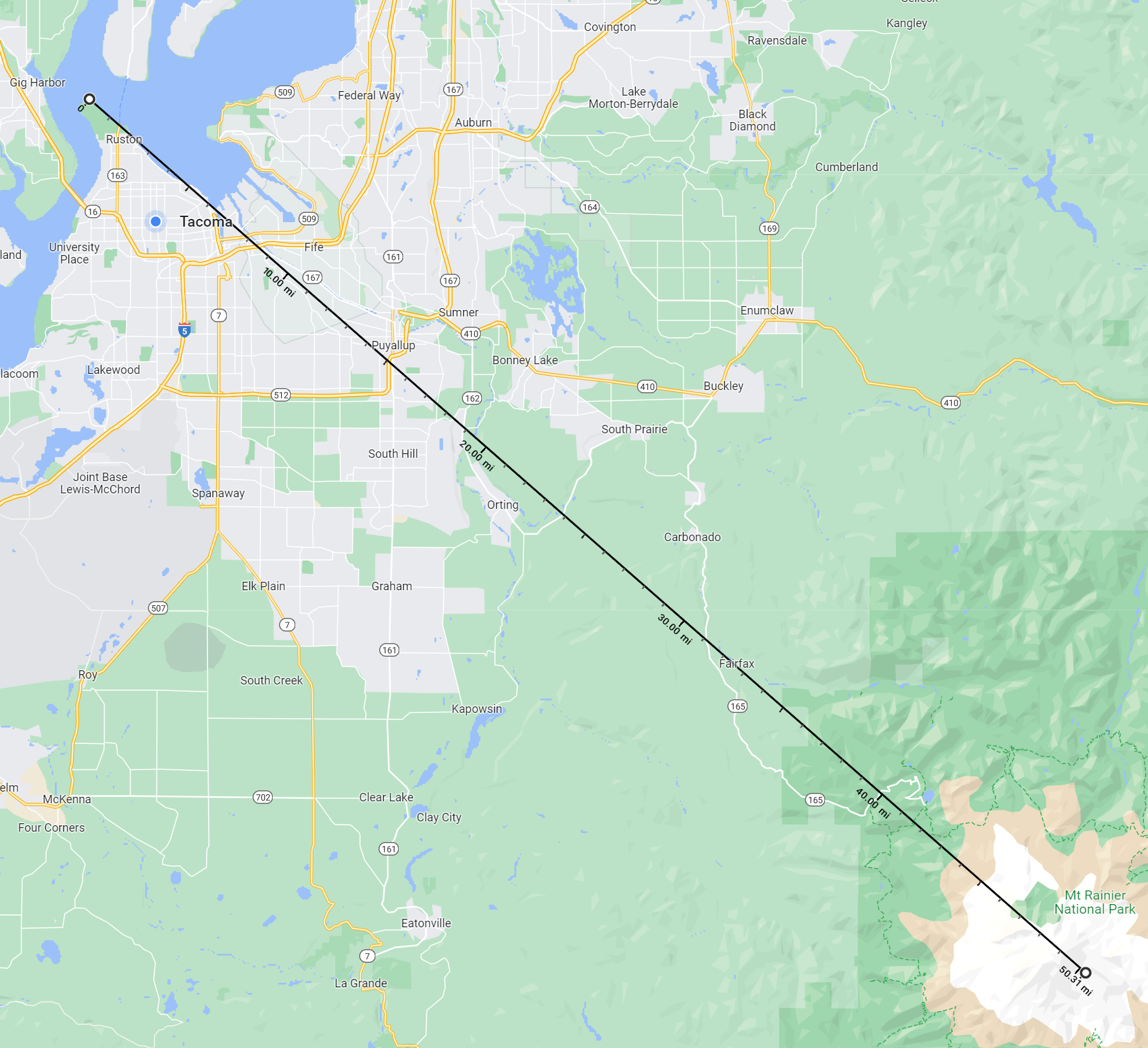
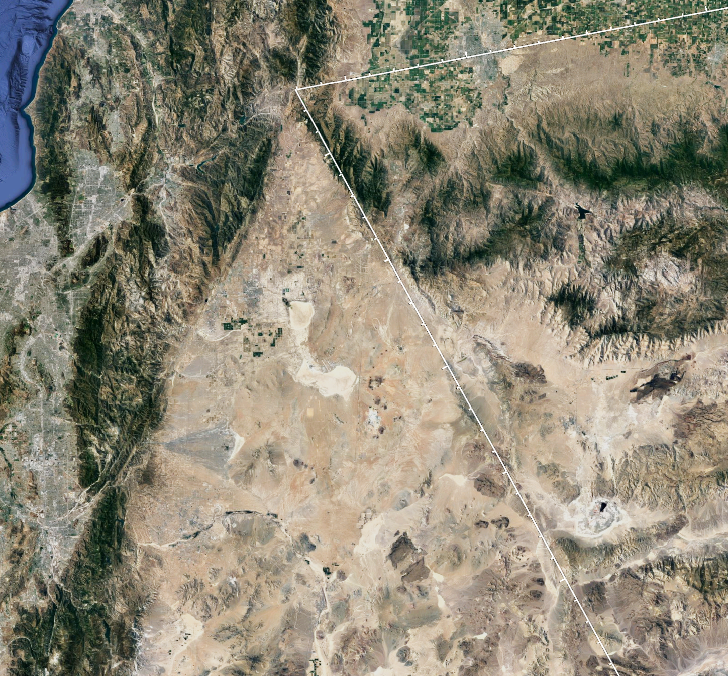
Following the line that goes from Tacoma’s Ruston shore to Mt Rainier again in the LA county triangle will take you back to Africa. If you look at the map upside down and compare, you can see that there is a corresponding feature to Days Island there. See it? Yup, it’s Madagascar. So its southern tip is where we lay down our end point.

Let’s now pause to take a moment to look at the line we’ve created and gawk at all of its Fallout significance. From Las Vegas (Fallout: New Vegas) to where the line departs the U.S. mainland from that island in Maine (Fallout 4: Far Harbor DLC) – we’ve got ourselves a line!

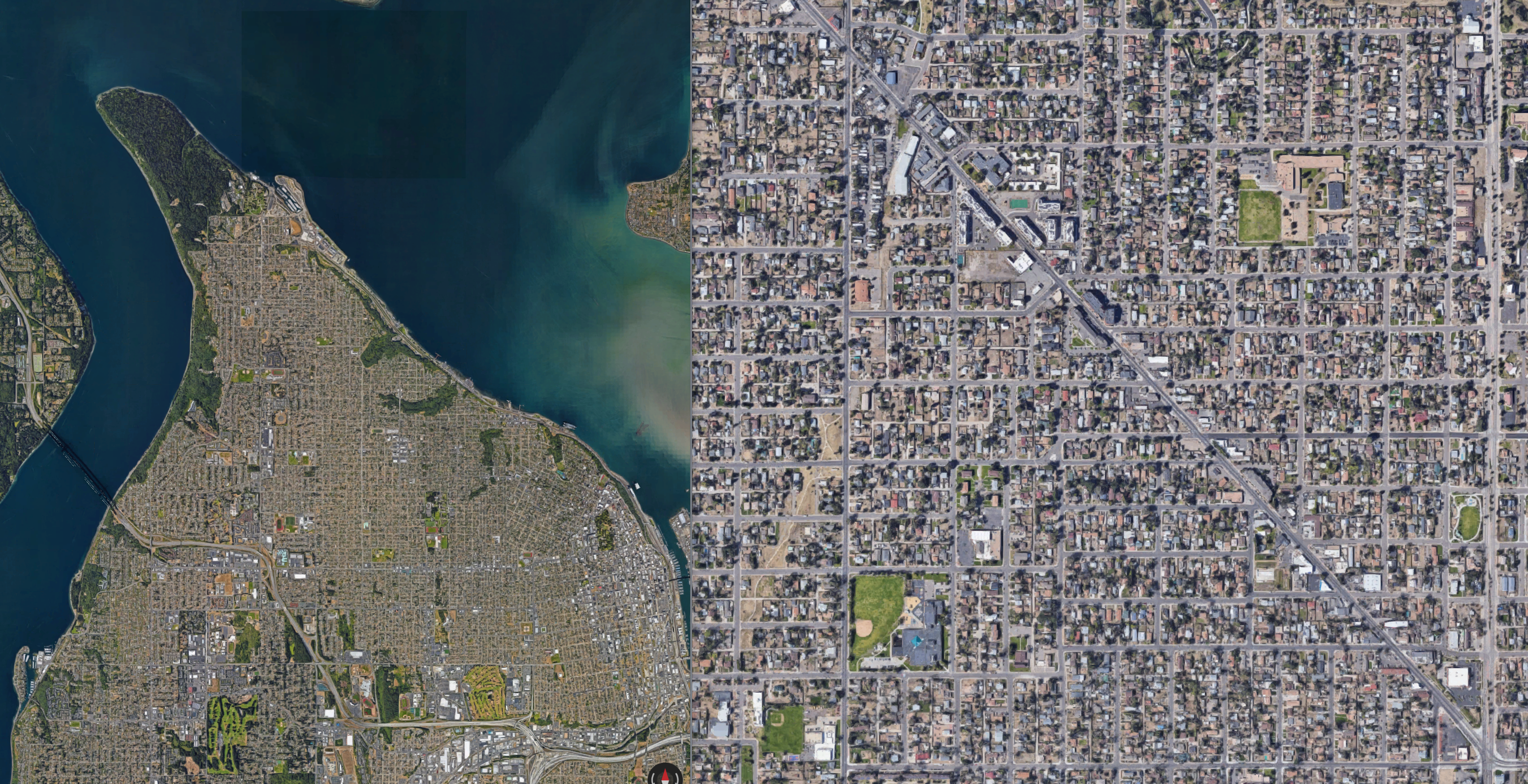
This line also passes through Colorado near Denver at Boulder, which is where our cartograstrology chart is to be mapped. At this point in our exploration of cartograstrology, any cartograstrologist worth their crystallized salt would be able to tell you about the Tacoma-Denver infrastructure connection, and if they can’t – well then they need to get their angle righted.
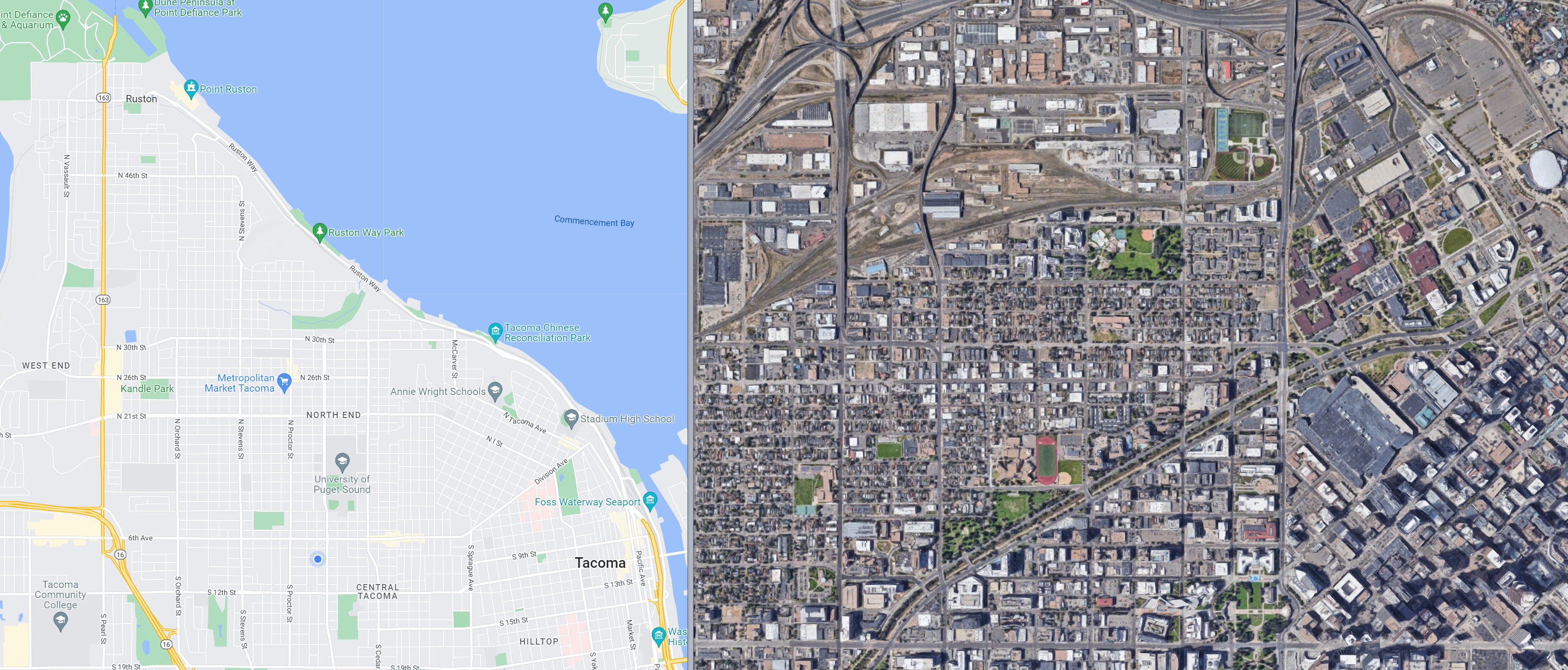
The next task for you is to identify where in Denver is the equivalent to Tacoma’s regarding the infrastructure. Go ahead. I’ll wait. Found it? You’re right – you noticed how the neat north-south-east-west grid pattern changes to diagonal when you get downtown in both cities. And Broadway is the 000 block that divides east and west, in the same way 6th Ave in Tacoma divides north and south. As you go down Broadway away from downtown, it’s as if you were going west down 6th Ave in Tacoma, and where the Highway 16 overpass and Scott Pierson Trail is in Tacoma you reach Speer Boulevard and the Cherry Creek Trail in Denver. Where Tacoma’s 16 is elevated, Denver’s trail is below street level. At this rate, the patternicity is sequential.
So, say it’s 2010 and you were a bettin’ cartograstrologist and you were lowkey keeping tabs on where I’d be going next and maybe you even had a pot going with your cartograstrologer buddies. What neighborhood would you be putting your money on? Well, because the pattern is so precise, there really is only one city block in Denver that it could be, so you’d be putting that money on an individual address in that neighborhood. Find that neighborhood yet? Right again – between Kalamath and Galapago and West 6th and West 8th Avenues.
Back in 2015 when I wasn’t even looking at the map anymore, let alone plotting cartograstrological maps, I got an invitation from my brother to join him in Denver at a cool place his friend rented for the purpose of intentional community building. It was called Inspire Life Studio and I said what the hey – I’m down. So I packed up my bike and shipped it to an address on West 8th Ave and Kalamath, and then moved into the house right around the corner that was purchased by the same guy renting the Inspire Life Studio’s suite. I’d stay there for the next year and a half and enjoy the releases of two of my favorite games, the other being No Man’s Sky. It’s destiny!
So, in my made-up story at the top of this page, how did I figure I’d end up in the Westwood neighborhood before the interview? Well, since I went to work at Pajama Baking Company and Govinda’s Garden, these two workplaces would then have to be placed on the map. Oh, and remember the mountains?
Since the mountains seem to be a “key” or guide, just put them all together.
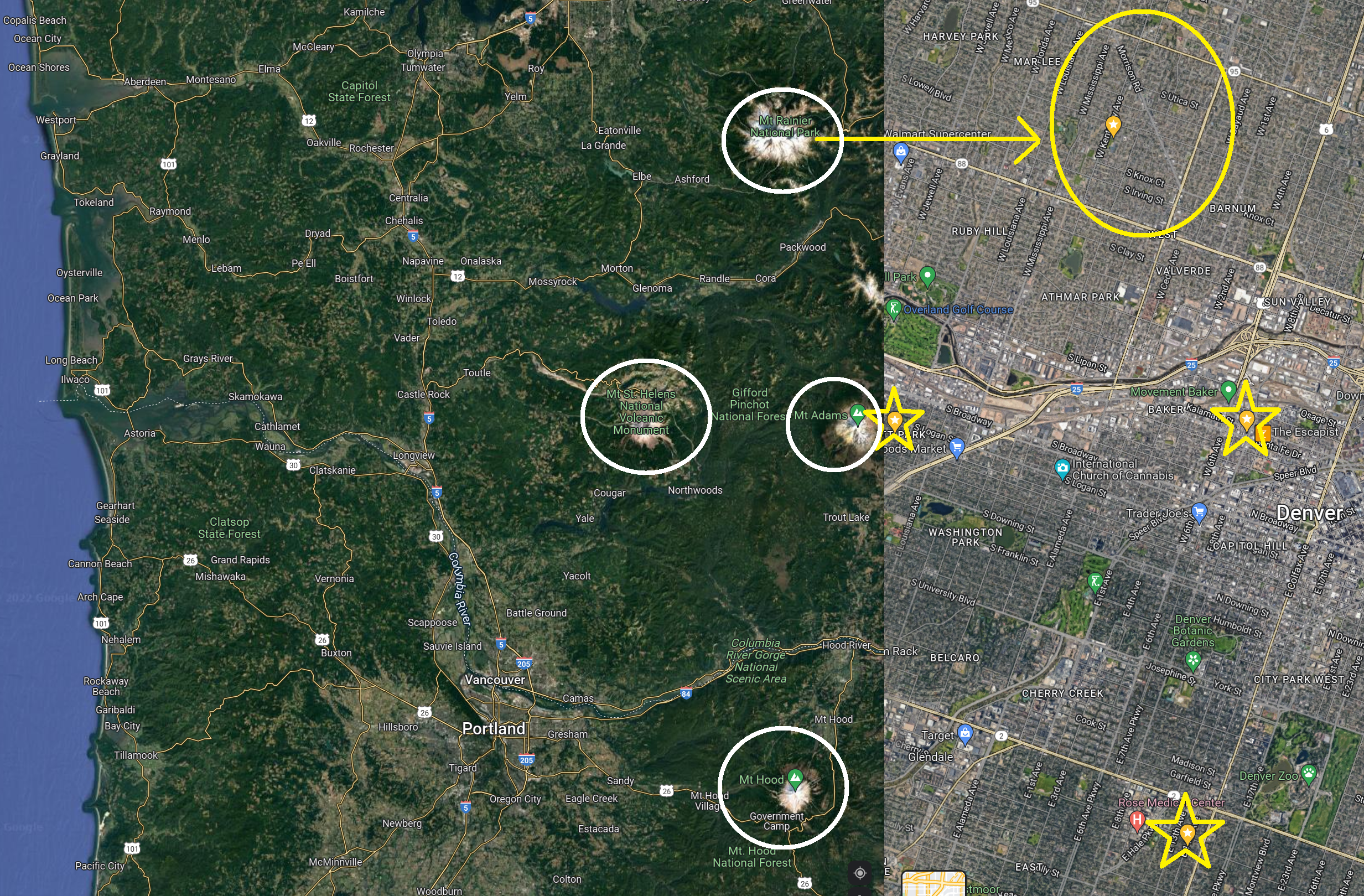
So, that’s how, in my story, I knew exactly where my new place would be before I searched the listings. Since elementary schools show up repeatedly on the line from my childhood home to my ’07 residence, the location of Castro Elementary as well as West Ohio Avenue’s placement within the triangle gives us really only one place that my second residence will be.
It’s too bad that I didn’t discover any of this until recently. What a missed opportunity to have some fun messing with my roommates minds! Surely cartograstrology has some other useful purpose, and even surelier others must be drawing up their own maps…
Best not to overthink it. I do still have to finish exploring The Island in Fallout 4 DLC, after all.